A Rusty Geospatial Adventure
Laurențiu Nicola
Motivation 🌳
- I'm not from Bucharest, been here since COVID
- This city isn't green enough
- Can we measure it, though?
- We'll try, using 🛰️!

Copernicus Programme
- Joint Earth Observation program between EU, ESA, EUMETSAT, ECMWF, JRC, EEA, EMSA and others
- Satellites, ground stations and sensors
- The data is available to anyone, for free and under an open license
Sentinel-2 Constellation
- Constellation of three satellites
- ~5 days revisit period (but beware of clouds!)
- ~110 × 110 km² scenes in a grid
- We're in tile 35TMK now

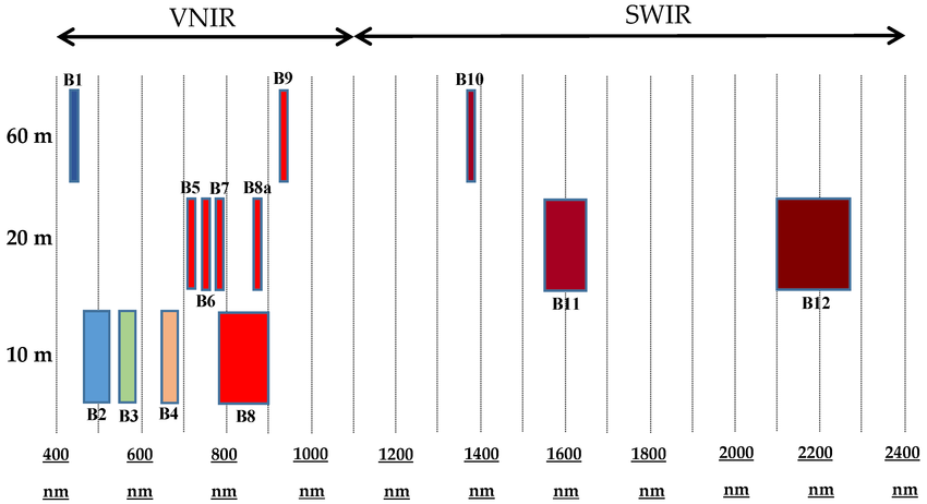
Sentinel-2 Multi-Spectral Instrument
- 4 bands @ 10 m (RGB, NIR)
- 6 bands @ 20 m (NIR, SWIR)
- 3 bands @ 60 m (aerosols, water vapor, cirrus)
Recognizing
Trees
Vegetation from Space
- Vegetation is green, but so can be water, roofs, shadows &c.
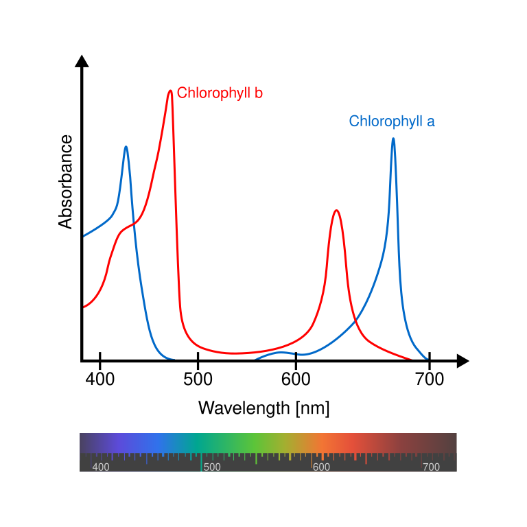
- Why are plants green?
- What is green anyway?
- Sunlight is white and has all the visible colors
- Green things reflect green and absorb the other colors

Chlorophyll and the NDVI
- Vegetation is green because of chlorophyll
- Chlorophyll absorbs blue and red
- Chlorophyll reflects green and infrared
- Look for things that absorb red and reflect infrared
- Normalized Difference Vegetation Index (NDVI)
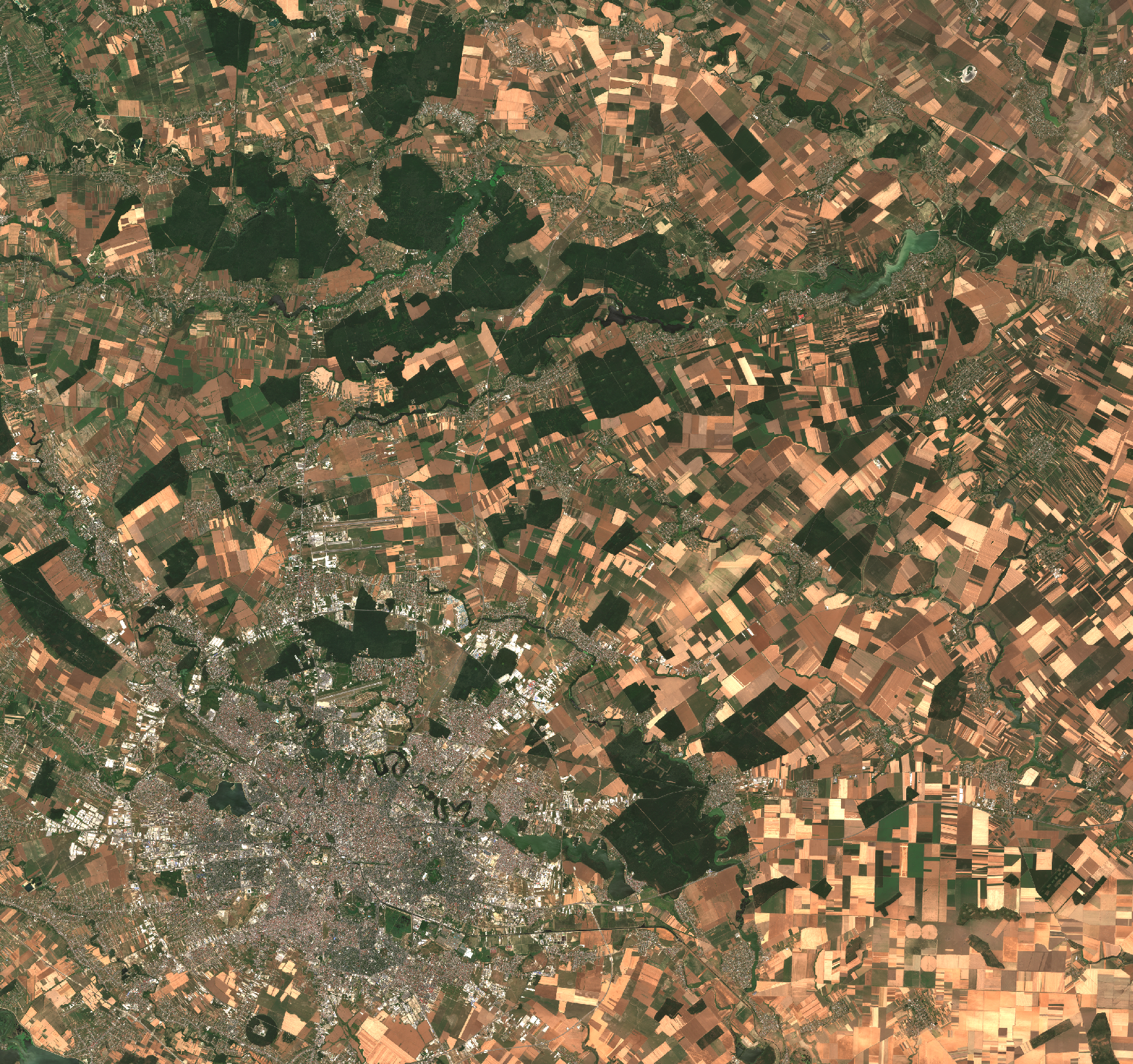
Interlude: True Color Composite
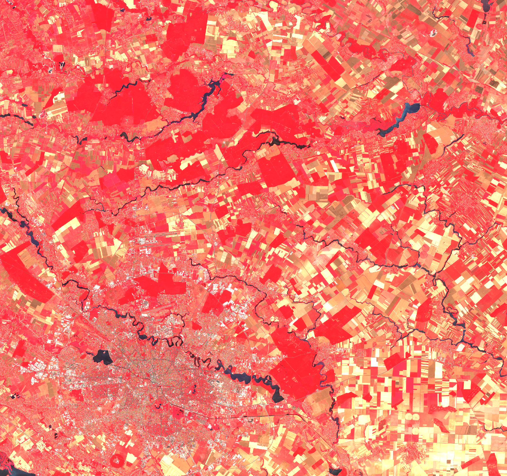
Interlude: False Color Composite
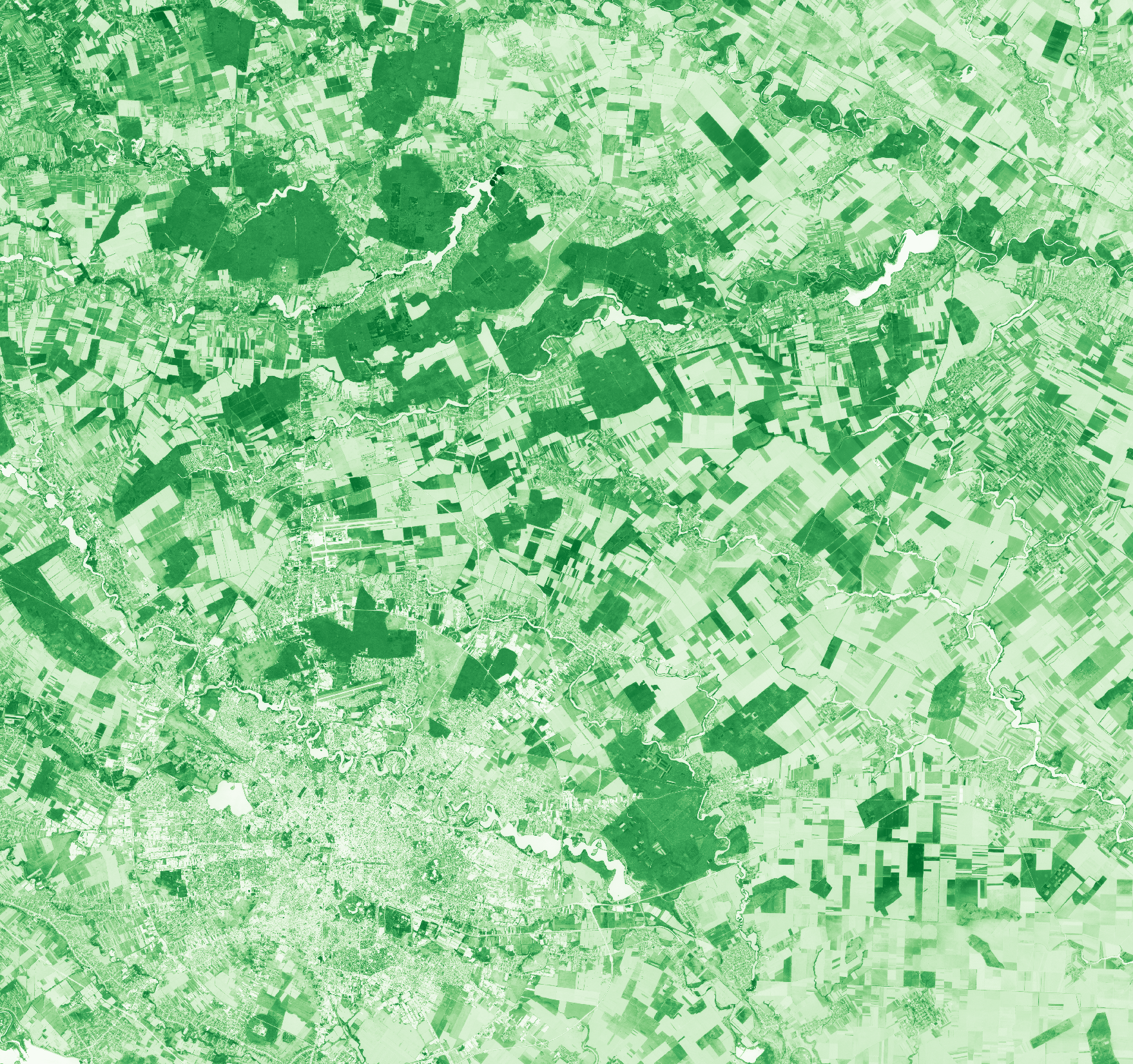
NDVI
- Shows photosynthetically active vegetation
- From −1 to 1, but negative values are not interesting
- Bare soils , sparse vegetation , dense vegetation
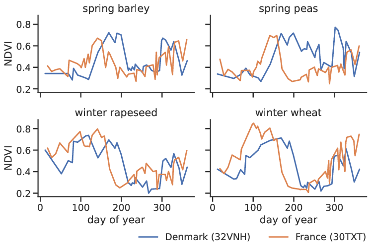
Crop Phenology
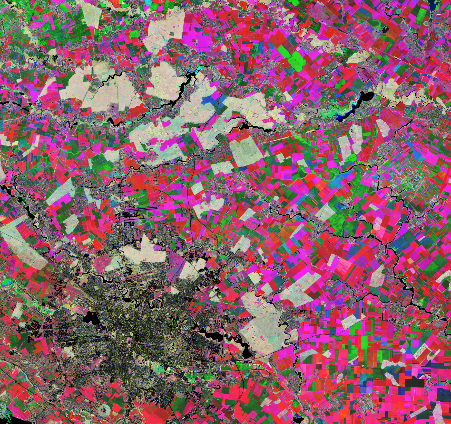
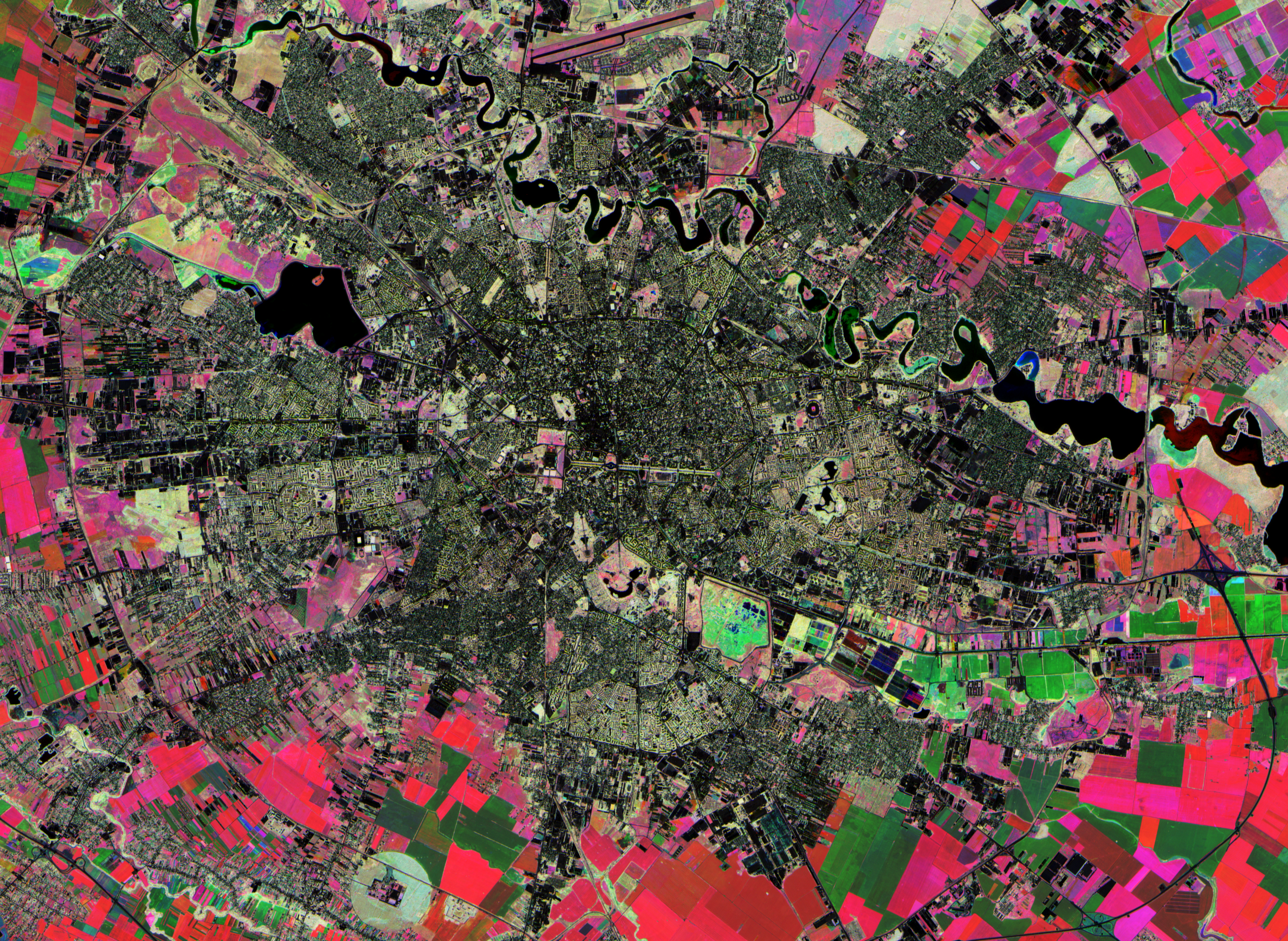
NDVI (3 Date Composite)
- Red / magenta: high NDVI in spring, early crops
- Green: high NDVI in summer, summer crops
- Yellow: high NDVI in spring and summer, trees
- Blue / cyan: high NDVI in summer and autumn, irrigated crops
- Black: not vegetation
Sentinel-2 Product Structure
                        S2B_MSIL2A_20241024T091939_N0511_R093_T35TMK_20241024T105557.SAFE
                        ├── GRANULE
                        │   └── L2A_T35TMK_A039873_20241024T091939
                        │       └── IMG_DATA
                        │           ├── R10m
                        │           │   ├── T35TMK_20241024T091939_B02_10m.jp2
                        │           │   ├── T35TMK_20241024T091939_B03_10m.jp2
                        │           │   ├── T35TMK_20241024T091939_B04_10m.jp2
                        │           │   └── T35TMK_20241024T091939_B08_10m.jp2
                        │           └── R20m
                        │               ├── T35TMK_20241024T091939_B05_20m.jp2
                        │               ├── T35TMK_20241024T091939_B06_20m.jp2
                        │               ├── T35TMK_20241024T091939_B07_20m.jp2
                        │               ├── T35TMK_20241024T091939_B11_20m.jp2
                        │               ├── T35TMK_20241024T091939_B12_20m.jp2
                        │               ├── T35TMK_20241024T091939_B8A_20m.jp2
                        │               └── T35TMK_20241024T091939_SCL_20m.jp2
                        └── MTD_MSIL2A.xml
-
Lots of files elided, but the reflectance bands are
under
R10mandR20m - Reflectance is the measure of the proportion of incoming radiation that gets reflected by a material
- In Sentinel-2 products, multipled by 10 000 and with a 1000 offset added
-
Look in the
MTD_MSIL2A.xmlfile to get the -1000 offsets -
SCLis a mask (clouds, cloud shadows, snow, water &c.)
Why Rust?
- High-level, you can use it like Python, nobody will complain
-
Easy to use, cf.
NameErrorafter running for half a day - Fast, on-par with C, even naïve code might be fast enough
-
Memory-safe, no
SIGSEGVs, no data races - Good libraries, and can call into any C library
- Good tooling and documentation
Reading Rasters in Rust
- We use GDAL, the geospatial I/O library
- New (GDAL 3.10) dataset thread-safety support, coming soon to Rust
- Can read regions of the input, to save memory
                                use gdal::{Dataset, GdalOpenFlags::*};

let open_flags = GDAL_OF_RASTER | GDAL_OF_THREAD_SAFE;
let ds = Dataset::open_ex(
    path,
    DatasetOptions {
        open_flags,
        ..Default::default()
    },
)?;

let mut data = ds
    .rasterband(1)?
    .read_as(window, window_size, window_size, None)?
    .to_array()?;
data.mapv_inplace(|x| x + offset);


fn ndvi(b4: i16, b8: i16, scl: u8) -> f32 {
    if matches!(scl, 0 | 1 | 6 | 8 | 9 | 10 | 11) {
        return f32::NAN;
    }
    let (b4, b8) = (b4 as f32, b8 as f32);
    if b8 + b4 == 0.0 {
        f32::NAN
    } else {
        (b8 - b4) / (b8 + b4).clamp(-1.0, 1.0)
    }
}
Raster Layouts
-
Generally, rasters use one of two pixel data
layouts:
- Tiles
- Strips: rows written in order
- Tiled layouts are usually more efficient because they allow processing of rectangular regions
- This is especially true for visualization
- Sentinel-2 uses JPEG 2000 (tiled, small, but very slow to decode)

A Rough Sketch
- Query products for desired time interval (e.g. CDSE STAC API)
-
Take rectangular blocks from each input
- first block from each input
- second block from each input
- …
- Read the blocks on a thread pool, send on a channel (queue)
- Single receiver thread reads dequeues blocks, computes mean NDVI, writes to output
- Don't compute the mean directly, but rather the sum and value count
- This means we can process the read regions immediately
Some Results
- On my PC, 2 minutes for 215 products over one year
- 18.5 GB on disk, 58.3 GB uncompressed
- 6-8 GB RAM, depending on region size and number of threads
- Basically all spent in OpenJPEG, but can saturate 32 cores
- On cloud VM, April - November, 100 products, 11 minutes per tile stack
- 3 for processing, 8 minutes to open the files 💀
- After cropping, mosaicking, conversion to 8-bit and compression: 3.4 GB
Potential Improvements
- Median NDVI (can't compute online)
- Combine with different indices (e.g. EVI)
- Multi-date classification
- Use a proper dataset for classification (e.g. ESA CCI-LC)
GeoRust
- Umbrella organization covering different Rust GIS projects
-
Geometry:
geo,geos*,robust -
Spatial indexing (k-NN query):
rstar -
Coordinate transforms:
proj*,geodesy† -
Formats:
gdal*,netcdf*,gpx,geojson,wkt,wkb,kml,osm,transit,shapefile, STAC‡, PgSTAC‡, GeoTIFF‡ -
Utilities:
geozero,geocoding,geohash,polyline - Other tools:
rinex
*bindings
†not formally part of GeoRust
‡multiple implementations available, some in GeoRust, some not
†not formally part of GeoRust
‡multiple implementations available, some in GeoRust, some not
Resources
Choose your own adventure:
Thank You!


Bonus: Copernicus Satellites
- Sentinel-1: land and ocean
- Sentinel-2: land
- Sentinel-3: ocean and land
- Sentinel-5P: atmosphere
- Sentinel-6: sea level (altimetry)
- Sentinel-4: air quality
- Sentinel-5: meteorology
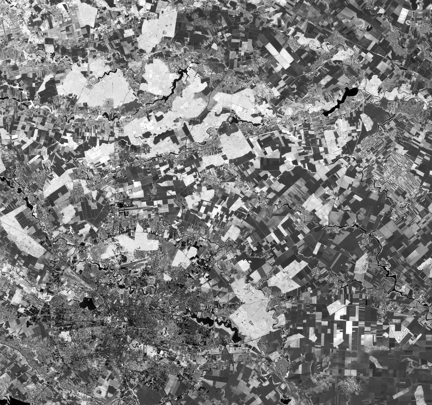
Bonus: Grayscale NDVI
Bonus: NDVI Composite @ 100%
